
The Montreal solution is arguably one of the more problematic and contested cases stemming largely from half-hearted verse and image applications not wholly indicative of trained communication. Concerning verse 5, city assignments are predominantly based on deductive obligation and depleting alternative municipal options versus the application of compelling contextual markers or convincing interpretive assignments to real world devices. A never ceasing supply of generic streets, drafty buildings, and white stones or masonry are excitingly proposed yet sparingly supported by anything more substantial than superficial and circumstantial matching equally valid at hundreds of alternative locations.
In contrast, the less conventional verse 8 assignment offers a predominantly agreed upon route with a logical linear progression of technically accurate and occasionally compelling interpretations. For devoted followers of this initially intriguing alternative, isolated successes overshadow and impair perceiving a litany of nagging directional omissions, inaccuracies, interpretive deficiencies, and instrumental elements missing in action. Verse 8 fails to include any convincing contextual indicators for Montreal and fails to clearly “wed” to the image. Alternatively, verse 8 effortlessly meets these same necessary conditions when paired with image 10 in Milwaukee. For a full verse 8 Montreal solution breakdown…click here.
In comparison to theoretical verse counterparts, image 9 is far more confidently applied to Montreal through observing a plethora of key identifiers such as geographic matches, accurate coordinates, the inclusion of “Expo ’67” elements, and the unquestionable depiction of the now iconic “legeater dog”: a leg swallowing oddity immortalized in the casted metal base of ornamental lampposts outside of Le Mount Stephan’s on Rue Drummond in Montreal.

An image 9 association with Montreal is clearly intentional, but to serve what purpose? Can it only lead to a casque in Montreal? Is this expectation compatible with recognizing the subjective nature of someone else’s puzzle? Could Montreal connections in this case alternatively serve as misdirecting allusions to historical or cultural elements associated with another location entirely? To understand how and why image 9 and verse 5 apply to an alternative municipality..click here.
Adequately understanding the situation requires identifying any gaps or inconsistencies between interpretive claims and the expectations of Byron’s puzzle. One such issue is incorporating Dutch immigration on some level, indisputably associated with image 9. Montreal is exceptional for its historic lack of Dutch immigration in a Canadian province with otherwise high concentrations. Most Montreal proposals utilizing common assignments either incorporate negligible Dutch references, inferences not necessarily tied to immigration specifically, or make no attempt at all. While a qualitative immigration reference can counteract a quantitative absence, an even marginally compelling example remains to be seen.
Vetting proposed image and verse combinations requires identifying a common element shared amongst them, known as “wedding” and referenced by the book. Contextually fusing image 9 with any verse in a clear and compelling manner is achieved exclusively by combining the opal found on the man’s hat with “white stone closest” in verse 5. Since wedding image and verse is an explicitly identified puzzle requirement, this would seemingly eliminate any alternative image 9 verse pairings from contention.
Based on our current theoretical framework we can assert the following:
-Verse 5 offers no compelling contextual evidence of a Montreal association
-Image 9 can ONLY be associated with verse 5 resulting from the “wed line” “white stone closest”
-While image 9 is connected to Dutch immigration through the opal, Montreal offers no compelling, puzzle supported examples
-Verse 8 is unlikely to belong with Montreal because it does not “wed” to the assigned image nor offer any compelling contextual association with Montreal
If these conclusions hold, we can effectively eliminate verse 5, verse 8, and image 9 from contention for a Montreal solution. So, what in the world do we do with Montreal?!?!?
If you’ll notice, image 9 and image 7 oddly share a handful of striking and possibly relevant similarities. They are both associated with French influenced cities, include a checkerboard pattern, display hands in peculiar positions…and depict golden squares. Image 9 is associated to Montreal via the “Golden Square Neighborhood”. What if we test that same association applying image 7? Given that French immigration is undoubtedly tied to image 7 as a result of the turquois gemstone and associated Litany of the Jewels clue, applying French immigration to Montreal on paper would certainly make a lot of sense.

Image 7 is customarily associated with New Orleans, and for good reason. Amongst other things, the painting includes the geographic coordinates for New Orleans, the word “Preservation” is logically associated with Preservation Hall, and the white mask shares a clear resemblance with Louis Armstrong. However, these are some pretty “obvious” references in a treasure hunt called “The Secret” unsolved for over 40 years. What if these references serve an alternative purpose? What if you are supposed to notice these things because you are supposed to misinterpret them as an act of misdirection? Consider that the coordinates appear in plain sight in direct opposition to almost every other instance coordinates are provided, usually hidden in a vast array of media including vines, hair, and stone crevices. The way in which the coordinates are presented we are seemingly presented with a choice: combine the numbers 29 and 90 for New Orleans or 19 and 29 for some place else entirely.
The appearance of a mask symbolically suggests hidden meaning or hidden identity. What if the easily perceived New Orleans characteristics serve as a mask? Could the painting’s ultimate identity be hidden beneath surface level misdirection; the most prominent features serving to explicitly indicate the “wrong city”? This would mirror the creative choice of representing a “black” man with a white mask, otherwise identified as Louis Armstrong based on distinct physical features and cultural relevance. As it happens, Montreal hosts a surprisingly strong jazz culture originating in the 1920s, while New Orleans founder Jean Baptiste LeMoyne de Bienville was born in Montreal and has a memorial in New Orleans referencing both Montreal and Canada.

If Montreal holds the key to unlocking image 7, a strong geographic match should present itself in the approximate vicinity of Golden Square Mile. Of particular interest is a suspiciously configured hand lacking any visible body past the lower arm.
Analyzing the monstrous hand equipped with pole mounted mask, we find a startling representation of Peel Basin. The features of the hand emulate the features of the basin: the two top fingers match the locations of the two canals or ports (even representing the space between them), the thumb matches the location of the Lachine Canal, the other two balled up fingers match the location of the basin itself (and as a result have no space between them in the painting), and the small waterway to the south matches a dark line in the palm of the hand. The stick the hand is holding lines up perfectly with Rue Peel (Peel Street), while the nails of the hand just happen to be chipping and “peeling”.

As previously acknowledged, the mask is intended to represent Louis Armstrong. While precise dates are difficult to establish, while on tour Armstrong played at a popular club in Montreal called Rockhead’s Paradise, which was the first Black owned business in Montreal. When superimposing the map and lining up corresponding geographic features as indicated, the mask from image 7 falls roughly over the former location of Rockhead’s Paradise in the “Little Burgundy” neighborhood, clipping the south-east edge of Golden Square Mile, reminiscent of the mask covering a sizeable portion of the clock face’s lower left quadrant. In this respect, when applying the mask to the map, it interacts in a similar fashion compared with image 7.
It is important to establish that while the current configuration of Peel Basin matches its historical condition, it was backfilled from 1970 -2002, including the time period Byron would have visited. There are a few possible, logical explanations for this theoretical discrepancy. First, while Byron would have visited Montreal, a physical tour of the basin would prove unnecessary given its exclusive application as a geographic clue. Thusly, he may or may not have been aware of the 1981 condition. Second, if Byron relied on depictions found in maps or reference materials, they might not have reflected the 1981 condition. The third possibility is that Byron knew it was backfilled, depicting its historic form with purpose. More on that momentarily.
The basin is specifically in the Griffintown neighborhood of Montreal, and what looks like a griffin head is seen within the checkerboard pattern in the lower right quadrant of image 7. The head is surrounded by distorted squares that emulate a water submerged surface, while the entire south-east boundary of Griffintown is along water, including a section of the Lachine Canal and Peel Basin. For the record, this creature’s head far more closely resembles a griffin as opposed to the commonly contended horse, whose head and neck feature an entirely different structure.

Some assert that this same shape, when turned 180 degrees, resembles the state boundaries of Louisiana. While the northern, western, and northeast edges of the state are reasonably depicted, the sum of remaining features are misrepresented entirely. Although any inaccuracy of state boundaries should be taken in context considering the difficulty of representing two concepts within a single shape, a Louisiana association is not conclusive.
Alternatively, comparing the disembodied head to the province of Quebec in support of a Montreal solution applying image 7, offers an intriguing pseudo match of comparable weaknesses. While the northern and western borders are not remotely similar, a suspicious level of mirroring exists on the Newfoundland and Labrador side of the province continuing south. The neck, lower mandible, open mouth, upper mandible, and brow ridge all reasonably correlate to eastern border features of Quebec province. Anticosti Island even resembles the eye of the creature and is found at a comparable, adjacent location.

The top two fingers of the hand form what looks to be a “77” and the fingers below them are “closed”, while rockhead’s paradise closed in 1977.

Notice also how the mask is covering a specific period of time on the clock which covers the 6, 7, and 8 o’clock positions. We could also interpret these numbers as 30, 35, and 40 if considering the minute designations. If we correlate these numbers to years between 1930 and 1940, Rockhead’s paradise was open, Peel Basin was in it’s current configuration, and Louis Armstrong was to my knowledge touring to some degree at this time. So, the mask covering the clock is identifying a specific period of time in which the applicable events occurred.
Notice also how the hand is holding the stick and specifically which fingers are touching it. There are two separated fingers and two connected fingers contacting the pole, while the thumb does not contact the pole itself. So, we have one finger, one finger, and two fingers touching the pole that represents Peel St.…and Peel St. is also known as Route 112.

Directly above the mask is a partially obscured shadowy blob matching the northern contours of Montreal. Beyond acting as a geographic match of the city in this Montreal solution, this device serves as an educated play on words. On the one hand, Montreal contains significant deposits of various rock types, while on the other hand, it’s image 7 counterpart appears on a “head”. Put your hands together and you get “Rockhead”, as in Rockhead’s Paradise, which then connects back to Louis Armstrong beautifully.

Before moving on, let’s adequately absorb and perceive the monumental implications of the preceding evidence for the Montreal solution. These are not simply “matches” but rather an intelligently communicated network of information working harmoniously toward illuminating a singular possible truth existing in a condition statistically impossible to manifest coincidentally. We have three methods for vetting the “pole” as highway 112/Rue Peel. The mask which convincingly emulates Louis Armstrong correlates to a location Louis Armstrong frequented, includes a rebus of sorts to indicate the club’s name, falls over a “golden square” while the club existed two blocks from the Golden Square Mile neighborhood, and falls on a time period on the clock that correlates to a range of years applicable events and conditions were relevant. The pale, hair covered hand which provides accurate geographic mirroring with the Peel Basin and expresses both names of the road the “pole” lines up with, also indicates the closing year of Rockhead’s Paradise.
Sadly, many will impulsively dismiss clear evidence of a singular possibility to follow assumptions and preferences that have never produced results, exclusively believing in such an answer without a casque, while proclaiming that only a casque proves an answer in direct contradiction to that very principle.
While these connections are extremely compelling, a potential counter argument arises with the appearance of the English word “preservation” applied to a French speaking location. So what is the French word for preservation? As it turns out, the French word for preservation is spelled exactly the same except with a diacritic (or slanted line) above the first “e”. If you look very closely at the word preservation in the painting, the diacritic appears exclusively over the first “e” as it should, suggesting a French connection as opposed to Preservation Hall which alternatively serves as purposeful misdirection.

An element central to the function and narrative of the Montreal solution is the square golden clock face appearing in image 7, alluding to the Golden Square Mile neighborhood of Montreal. Amongst other things, the clock orients you to the proper area to investigate and identifies key locations in the puzzle. The clock hands point specifically at the 12 and 3 o’clock positions. Centering the golden square over the Golden Square Mile on the map places the twelve o’clock position roughly around the Montreal Museum of Fine Arts. Looking at the large clock hand, there is a crescent shape which appears perpendicular to the numbers 1,3, and 8 in that order. Subsequently, the museum is located on the corner of Crescent St and Route 138, while two streets forming an intersection are perpendicular to one another.


Southwest on route 138 is the “Grand Lodge of Quebec”. The corner stones for this building were laid in 1929, while 19 and 29 appear in the corners of the golden square clock face in the painting. This location is on the edge of Golden Square Mile (as identified by online sources, the border identified on Google maps deviates from this) and the numbers that represent this location are on the edge of the golden clock face in the painting, establishing rough parameters for our treasure map and identifying what is located in G.S.M. Since the lodge is four blocks from the art museum, I wondered where 4 blocks in the other direction would get us. 4 blocks northeast on 138 gets us to Peel Street. Dorchester Square is also on Peel St., is in G.S.M, and aligns with the three o’ clock position.

In the shadow
Of the grey giant
The Mount Royal Cross is a giant grey structure towering 103 feet above the ground, mounted high atop Mount Royal at its northeastern peak. We stand in the cross’s figurative “shadow” at the mountain’s base along Park Ave. The cross was given to the city in 1929 which is the year indicated in the painting in the top two corners of the clock.

Curiously, an isolated collection of squares within image 7’s checkerboard backdrop contain a diagonally sectioned dual tone format. This design generically matches crossbars found within the support structure of the Mount Royal Cross. Outlining the most distinct examples does form a cross shape, but it fails to offer an unquestionable association.

Find the arm that
Extends over the slender path
The George-Étienne Cartier monument includes the Goddess of Liberty on the top, extending her arm over the “Olmstead trail” beneath. This trail is referred to as “Chemin Olmstead” in French which when directly translated means “Path Olmstead”. While the pathway is not currently “slender” by personal standards, historical photos suggest a narrower path, and sections of the current path include two distinct strips of differing materials fused together at some juncture. About the best we can contend is that this path in its current form is narrow relative to the street. While this pathway’s condition of narrowness is not very compelling, it is the application of other qualifying elements which renders it viable.

The monument also provides an important contextual clue as the giant cross can be seen from many areas of the city, but if you need to see an arm extending over a path while viewing the giant cross, this criteria narrows our search parameters exponentially. The area in which the monument appears shares a striking resemblance to our clock from the painting, with a large square and smaller half-moon shape present.

Historically, a portion of the eastern half of modern Canada was divided into three British provinces until a process of unification referred to as the Canadian Confederation was initiated, subsequently forming a single federation known as the Dominion of Canada of which two additional provinces soon joined. The George-Étienne Cartier monument celebrates that event through a metaphorical representation of the union responsible for shaping modern Canada. Offering a few circumstantial possibilities, the moon and stars above the image 7 golden clockface can be aligned to spell the word “union” (as Scott Harrison has suggested for New Orleans), and when turned sideways, the golden arch looks like a letter “c”, possibly signaling the Canadian union. In addition, Cartier himself is clearly of French decent, integrating our obligatory immigration component.
Of additional note, while the moon and stars are found directly above the golden clockface as a separate yet connected characteristic, the Cartier monument is just outside of the “Golden Square” Neighborhood to the north.
In summer
You’ll often hear a whirring sound
Cars abound
In the Summer season, there is a lot of bike riding on and around Mount Royal. Bikes do indeed create a “whirring” sound, which also connects to the Japanese translation clue stating the whirring sound is manmade and mechanical in nature. The ornate minute hand in image 7 even vaguely resembles a bicycle.

In this location there are cars everywhere as you are surrounded by parking lots for a university, the Montreal Alouettes stadium, and a medical facility. Passing these parking lots has you travel southeast on “Park” Ave toward the inner sanctum of the city where additional cars are inevitably present.
Although the sign
Nearby
Speaks of Indies Native
The natives still speak
Of him of Hard word in 3 vols.
The word “nearby” is an open-ended, relative term, that could theoretically cover a degree of distances. “Nearby” could equally qualify as a few feet, hundreds of yeads, or a mile. Given this context, slightly longer than a mile from the Cartier monument, at the entrance to McGill University, is a bi-lingual plaque commemorating the Native town of Hochelaga visited by French explorer Jacques Cartier, which would have been located near the plaque while the exact location of the fortification remains contested. The language from the verse is important. Not only does the verse say “nearby” and the plaque says “near here”, but the fact that no one knows the exact location of the village matches Byron’s decision in this Montreal solution to let the searcher find the sign “near” their previous location versus leading them directly to it.

The plaque shares an uncanny resemblance to the image 7 clock with arched top, symbols of some kind flanking the upper corners, square body, and fasteners in four corners mirroring the 29,90, and 19 respectively.
Jacques Cartier made three voyages to Canada focusing his efforts on what is now the Gulf of St. Lawrence and the St. Lawrence River and is responsible for, amongst other things, naming Canada and naming Mount Royal. Since Mount Royal is comprised primarily of hard igneous rock, and Cartier who named it made three Canadian voyages interacting with the native peoples on each of those occasions, Cartier is the “Him of Hard word in 3 vols.” referred to in verse 10. Notice also that the Hard is capitalized, suggesting that the subject is a proper noun. For those who insist on a more literal application for “volumes”, Cartier, as most major explorers did, kept journals of his journey. Three journeys…three journals…three volumes.
In the Japanese clues, Byron said arriving at the answer for this particular clue requires engaging in an unspecified brand of word game beginning with the word “chicken”. If your word starts with “c” and ends with each letter of the alphabet starting with “n”, you can easily arrive at the word Cartier, further authenticating this Montreal solution.
In review, we are directed to a sign “nearby” while we find a sign near our previous location including the words “near hear” referencing the Village of Hochelaga. The sign speaks of an Iroquois fortification, while the historical classification of North and South America as the “West Indies” would make any inhabitant thereof an “Indies native”. The verse proclaims the “natives still speak” while Montreal continues to host a significant Native “Indian” population. The previous lines all relate to “him of Hard word in 3 vols.” while explorer Jacques Cartier fits all pre-established qualifiers, visited pre-colonial Canada in three installments, and is directly responsible for naming Mount Royal which is comprised of “hard” igneous rock making the name “hard” by association.
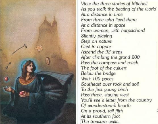
Take twice as many east steps as the hour
Or more
The word “step” is ambiguous terminology that can have many meanings beyond physical stairs or a literal human step, which themselves represent the typical theoretical interpretations. Collectively across all cases, the word step or steps appears on six different occasions. In Cleveland, it is applied as a human step forward, for the purpose of ascending a literal stair, and climbing onto a planter ledge in a single instruction. In San Francisco step is utilized to delineate two plots of land, skipping one to arrive at the other. In Boston, “step” is applied synonymously with stops on the Boston subway. For verse 1 it is impossible to assign without a better understanding of a compelling verse application in totality. Milwaukee employs 92 steps as plots on the map to bridge a large distance between Kosciusko Park and National Ave.
For the Montreal solution, we have two primary components for qualifying our steps. First of all, we are instructed to multiply the “hour” by two to arrive at the correct number of “steps”. This instruction further validates our image choice which includes the depiction of a clock for gauging the “hour”. Second, our steps should be taken east, but perhaps not perfectly so.
To begin this instruction, we must first identify what the hour is…which quickly proves problematic. Two hands are immediately visible: a long, overly ornate hand…and a short discrete hand comprised of a single straight line terminated by a small bulb. Quite the juxtaposition. Can we be sure what we are looking at and how the application of each hand concerning a time is intended? Is the hour hand being concealed by minute hand? Is the shorter pointer a second hand and do grandfather clocks have those?
The one universally consistent set of defining characteristics we can count on all clocks possessing, regardless of ornamental flourishes or lack there of, is that the hour hand is ALWAYS shorter than the minute hand. As it relates to grandfather clocks, they may contain a secondary dial for delineating seconds, but never a second hand integrated within the primary mechanism with the other hands, unlike many modern time pieces. Examining the excessively scrolled pointer, we can perceive no overlapped component concealed by the first. The most reasonable conclusion we can draw, for the purposes of interpreting line 13, is that the grandfather clock of image 7 indicates the 3 o’clock position. Such an unexpected and unusual dynamic fits perfectly within a puzzle theme of unexpected dynamics.
To take twice as many steps as the hour (or more) subsequently requires the application of 6 currently undefined units bridging a gap between our current location and our next. So what is a “step”, and why might we need to take more than six? Physical steps are unlikely given that six physical steps gets you nowhere, we are given no undeniable waypoint from which to initiate steps, we are near nothing that accurately fulfils verse or image, and the hypothetical margin of error established by the words “or more” could be generically applied to justify any number of “steps” seemingly defeating the clue altogether. What if we apply steps as map plots or city blocks? What is the result?
Before moving on, a few additional details should be noted. The Hochelaga memorial was originally placed to the left of the Roddick Gates and was not moved until 2016. It just so happens, that the left pillar, and only the left pillar, has a clock face that shares interesting attributes with image 7. The same gold/black color scheme is represented although reversed, there is a circle within the clock face, a square that surrounds the clock face, a frame that further surrounds it, and a rectangle beneath it. At the exact point we are instructed to take twice as many steps “as the hour”, we are next to a clock that emulates the image we are intended to apply.

Applying line 13 of verse 10 in this manner, we travel six blocks from the Roddick Gates (near the Hochelaga monument) on Sherbrooke St. W. in an east bound orientation (southeast to be precise) concluding this instruction one block north of Dorchester Square. Given this interpretation, what relevance would taking additional steps serve? As it happens, this minor detail reinforces our decision making as counting blocks on both sides of the road would accrue additional “steps”.

From the middle of one branch
Of the V
Look down
And see simple roots
In rhapsodic man’s soil
After arriving at the 6th “step” on Mansfield St. between Rene-Levesque Blvd. W. and Rue Cathcart, looking down at the ground will serve little purpose as there is no “V”, vegetation, or soil to be found in our entirely urban setting of manmade structures. Since the previous instruction can be completed either at ground level or from a map perspective, perhaps applying the later may facilitate a relevant discovery. One block south of our current position is Dorchester Square, containing two sets of “V” shaped pathways flanking two sides of the Boer War Memorial.
Arriving at Dorchester Square elicits an interesting effect. While the clock hands were applied earlier in the interpretation in conjunction with multiple landmarks corresponding to image devices indicating Dorchester Square at the three o’clock position, traversing six city blocks interpreted as “steps” based on multiplying the clock’s indicated hour as instructed by the verse…takes us to Dorchester Square!!! Two separate applications of the grandfather clock, specifically the indicated three o’clock position, lead to the same conclusion while existing in relative harmony with puzzle instruction and visual characteristics.
There is a shape to the right of the clock in the painting that emulates both the rectangular plots of and unaligned orientation between Dorchester Square and Place Du Canada.

When positioned in the middle of one branch of the V shaped path, in perfect compliance to verse instruction, we look down to find grass covered soil, offering vegetation with “simple roots”. An approximate “middle” placement finds us adjacent to the Robert Burns memorial occupying the same ground.

While “rhapsodic” is defined primarily as a strong expression of feeling commonly associated with literary or musical compositions, Robert Burns was a renowned Scottish poet whose material was marked by extreme contrasts of emotional disposition.

The Secret’s Japanese translation speaks of a “famous song” connected to the “rhapsodic man” while Robert Burns is responsible for authoring the unofficial New Year’s anthem Auld Lang Syne.
Identifying “rhapsodic man’s soil” marks an indispensable distinction in this Montreal solution as two sets of V shaped paths exist on either side of the Boer Memorial in Dorchester Square. This illustrates the purpose this device serves versus the generic existence most interpretations suffer from.
Or gaze north
Toward the isle of B
To “gaze” suggests a lengthy look requiring considerable effort or investigation, and “toward” could imply in the general direction of and not necessarily due north. North of Dorchester Square (and a little east) is Bourdon Island; intersected by Route 138 which appeared earlier in the puzzle and is also represented in the clock hand as previously identified.

The purpose of the word “or” in this instance is not entirely clear, as the previous instruction applied to identify the correct V shaped pathway is indispensable, while finding on island on a map serves little purpose beyond allocating an additional site confirmation, revisiting route 138, as well as providing a red herring context clue for New York City.

While we have now concluded our verse interpretation for this Montreal solution, we are given no explicit digging prompt, any apparent landmark, nor any process by which to narrow a precise dig location, forcing a shift to the image, which just so happens to include a character pointing at the word “dig” imprinted on his left leg. This would seemingly imply that whatever this figure correlates to on site offers a reference point from which to identify a precise dig spot.
The Boer War Memorial is the central element of Dorchester Square, in both a geographic and topical sense. It honors Canadian casualties of the geo-political conflict intended to maintain and secure British control over southern portions of Africa. The inclusion of a war memorial as a major puzzle device would appear to reflect the symbolic presence of a chess or checker board in image 7, representing two opposing sides. The granite mounted sculpture depicts a stoic soldier calmly restraining his agitated steed. If imagining the human figure untethered from his prideful pedestal, floating un-naturally at an altered position 90 degrees forward, compositing his upper-half as normally upright, we would discover a curious set of commonalities to the central figure of image 7’s golden clock face.
Both figures have spread and slightly bent legs, have their right arm extended and left arm bent inward, are wearing hats, and have expressionless and arguably generic male faces. The image 7 figure has some type of accessory behind his left hip manifesting as a dark bump, while the Boer figure has what appears to be a binoculars case hanging behind his left hip. The image 7 figure is interrupting a circle, while the Boer memorial interrupts a semi-circular garden bed. But why would a soldier be disguised as a news boy? Because Dorchester Square, and more precisely the exact casque location, is across the street from the Montreal Gazette.

Surprisingly, the northwestern boundary of Dorchester is home to an unorthodox, semi-circular fountain designed to look like a partially successful space-time displacement experiment, bearing an uncanny likeness to the half moon shaped turquois in image 7, but did not even exist in the park until at least 2019. However, what would have existed in 1981 in the same location was a small arched shaped planter equally befitting of the image 7 depiction.
Based on this collection of evidence, the word “dig” on the newsboy’s leg suggests we align the left leg of the soldier with our dig location…but from what direction? An aerial perspective of Dorchester unlocks an organized series of correlations to the clock face in image 7. Both the clock hands and the park pathways form an “L” shape. The floating man, oval, letter “V”, and arched shape gemstone appear in accurate, south to north progression when correlated with the Boer Memorial, oval shaped plot of the Boer, the V shaped pathway, and the arch shaped planter. While the minute hand barely intersects with one “branch” of the V as alluded to by the verse, pointing directly at the arched turquois, applying this imagery to a map view of Dorchester leads directly to the arched planter, implied as our casque location and certainly large enough to accommodate a 6in box.

The slightly off center minute hand would seem to imply a slightly off center casque alignment. If lining ourselves up with the appointed leg, we are just off center with the same V shaped path applied earlier. It should be noted that a number of additional image 7 elements are also slightly unaligned, such as the number 9 raising just above the number 1 in the 19, or the apparent hour hand misaligned ever so slightly with a precise three o’clock position.
The next question would be how is French immigration represented at our casque site applying this Montreal solution? We can certainly argue that the monuments found at the very beginning and very end of our interpretation express Canadian nationalism, which may foster a congruent theme but doesn’t relate inarguably to French immigration. However, Dorchester Square…was formerly named Dominion Square, in remembrance of the Dominion of Canada instituted in 1867. Each of the associated territories or provinces had previously been ruled by France.
In further support of our previous decision to apply the ornate clock hand as the minute indicator and the simple clock hand as the hour indicator, consider the general function of an analog clock. The hour hand gives you an hour span while the minute hand provides a more precise moment within that hour. When compared with the clock’s functioning in image 7 to indicate Dorchester Square, the hour hand indicates the general casque location, while the minute hand indicates our precise dig spot. This perfectly mirrors the function of an analog clock.
Steps away from the Boer Memorial along Metcalf Ave. we find the Lion of Belfort, a memorial fountain in celebration of Queen Victoria’s Diamond Jubilee. The royal lion’s intimidating paws guard a grounded arrow of peculiar plainness equipped with a simplistic triangular head distinguished primarily by a curved posterior edge, while matching arrows that point to either end of the word “preservation” in image 7.

Inspired by the original creation of Frédéric Bartholdi in Belfort, France, the faithful Canadian reproduction of diminished stature faces east toward France, in keeping with the French theme of this case, although arguably not explicitly related to immigration. Arguably just as significant, Montreal’s Lion of Belfort was constructed by George Hill, the same artist behind both the George Etienne Cartier Monument as well as the Boer Memorial.
As yet another clear association between the beginning and end of the Montreal solution, The Boer Memorial points toward the Mount Royal Cross which would have been visible from Dominion Square…until 1929…the same year referenced by image 7.
Upon successfully interpreting verse 10 in totality, it becomes evident that the verse of twenty-one lines is meant to be divided into three equal sections each representing a distinct physical location. This can certainly help to explain the otherwise uncharacteristic presence of arguably unnecessary verse inclusions or seemingly excessive line divisions.

It just so happens that the entire puzzle is filled with elements that occur in threes. In addition to the verse structure, there are three sets of numbers on the outside of the clock face, there are three numbers on the clock hidden by the mask, the clock points to the three o’clock position, Cartier made three trips to Montreal, three provinces originally comprised the Dominion of Canada, three monuments sculpted by George Hill are used, and there were three flags at the casque location representing the host country.
As revealed by JJP, the Boston image actually spelled out the word “Boston” using items within the painting, and not all in a precise order. Do you think any other images perform the same function? Image 7 sure does have an interesting number of indisputable letters. Can we use them to spell Montreal?
First, the “M” and the “O” are easily derived from shapes on the large ornate clock hand. Second, the middle four letters of Montreal are appropriated from the word “preservation” in the painting when isolating every third letter from left to right then applying them from right to left. While this method may appear entirely arbitrary and completely odd at first glance, it is based completely on clear puzzle principles. So why use every third letter you ask? Well, three is a reoccurring number in this puzzle as previously illustrated. The arrows are pointing to the word “preservation” from both sides, seemingly suggesting it has some significance when read in both directions. Using this method, we identify the needed letters from left to right, and read them right to left, using both directions. Also, the French version of the word Montreal has a diacritic over the “E” while we are using the same “E” from the painting we identified earlier as including a diacritic. Third, the “A” is used from the upside-down Roman numeral, and the letter “L” is created by the large and small clock hands together. The preciseness of the methods used, with numerous cues from the source material implemented, the chances of this being a coincidence are far less likely. Not only is it curious that we can spell “Montreal”, but also that spelling it would be impossible without the word “preservation” in the painting, giving further credence to its inclusion.

Lastly we have the Litany of the Jewel Clue speaking of a “rare…blue midsummer’s day”. I’m not completely sure on this one. Shakespeare in the park? An inference to the park adjacent “Sun Life” building? Inferring the establishment of the Dominion of Canada on July 1st, 1867? Not sure.
Montreal Solution Pros:
-Explains collective futility in both New Orleans and Montreal
-Accurately employs Japanese translation clues
-Middle verse section arguably serves as context clue to identify Montreal
-Shows significance of devices appearing in threes both in image and verse
-Utilizes more than just one for one matches, making use of image symbolism and a wide range of other visual devices
-Comprehensive and predominantly accurate application of verse concepts
-Illustrates geographic mirroring with many supporting elements for confirmation, particularly applicable to Peel Basin
-Accurate alignment of visual elements at casque location
-Weds image to verse via “twice as many steps as he hour”
-Compelling interconnectedness with 3 statues all created by the same artist
-Continuity between beginning and end of puzzle regarding Mount Royal Cross, Mount Royal, monuments of Canadian nationalism etc
-Explains collection of similarities between image 9 and image 7
-The word “near” from verse 10 is applied to signify the historical uncertainty pertaining to the precise location of the Hochelaga fortification, providing compelling context
Montreal Solution Cons:
-Strange dynamic for spelling out “Montreal” in image
-Identification of hour hand is a little subjective
-We are not in the middle of one branch of the V when looking a block south toward Dominion Square from a map view
-The first third of the verse is underwhelming interpretively speaking and arguably inaccurate
-Asserts that image 7 does not lead to a casque in New Orleans despite a gamut of clear matches
-Verse 10 includes what many consider clear context clues for New York City
-Does not use “legeater” for Montreal
-Isle of B interpretation is underwhelming and seemingly serves little purpose
-Less “obvious” verse/city context clue compared to other cases
Leave a Reply